
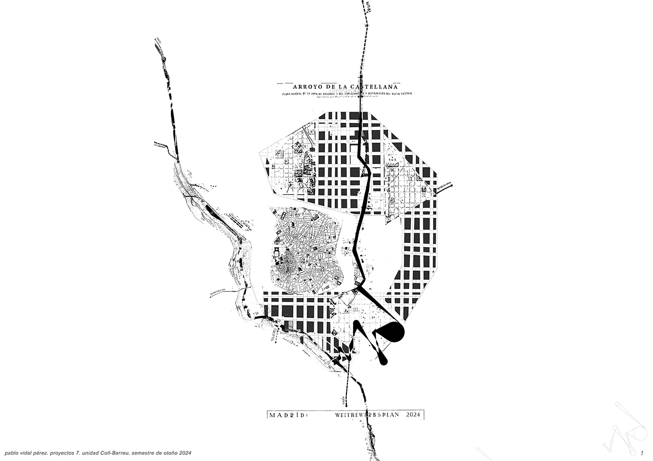
Arroyo de la Castellana
The Arroyo de la Castellana, an ancient watercourse that once ran through Madrid from north to south, originally flowed into the Arroyo Abroñigal and later into the Manzanares River. This stream was channeled and buried beneath the Paseo de la Castellana, from which it took its name. Over time, this natural feature disappeared from the urban surface, giving room to the city's key artery. However, this project aims to restore the presence of the stream and bring it back to life, reconnecting the city with its history and nature.
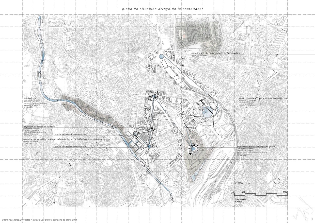
The plan proposes to unearth the Arroyo de la Castellana through a large excavation in the southern part of Madrid. This new watercourse will start in Atocha and flow again into the Manzanares River. Two types of interventions will be developed in the excavated area: circular and deep excavations and shallower ones that will connect the hubs, guiding the stream along its path.
The circular hubs will be large areas with bodies of water at their centers, each associated with an architectural space with a specific program. The shallower excavations will form natural channels that connect the hubs and allow the water to flow toward its ending. This strategy will not only recover the historic stream but also transform the entire city.
On the excavated land, housing, parks, art galleries, and community centers will be created, all directly interacting with the stream. This initiative will form a green axis that will revitalize the city and link its historical past with a sustainable future. In addition to recovering the stream, the project will explore the underground layers of Madrid, revealing existing infrastructure such as metro and railway lines, which will be harmoniously integrated into the design. The system of elevation changes in the hubs will allow the water to flow naturally from Atocha to the Manzanares.
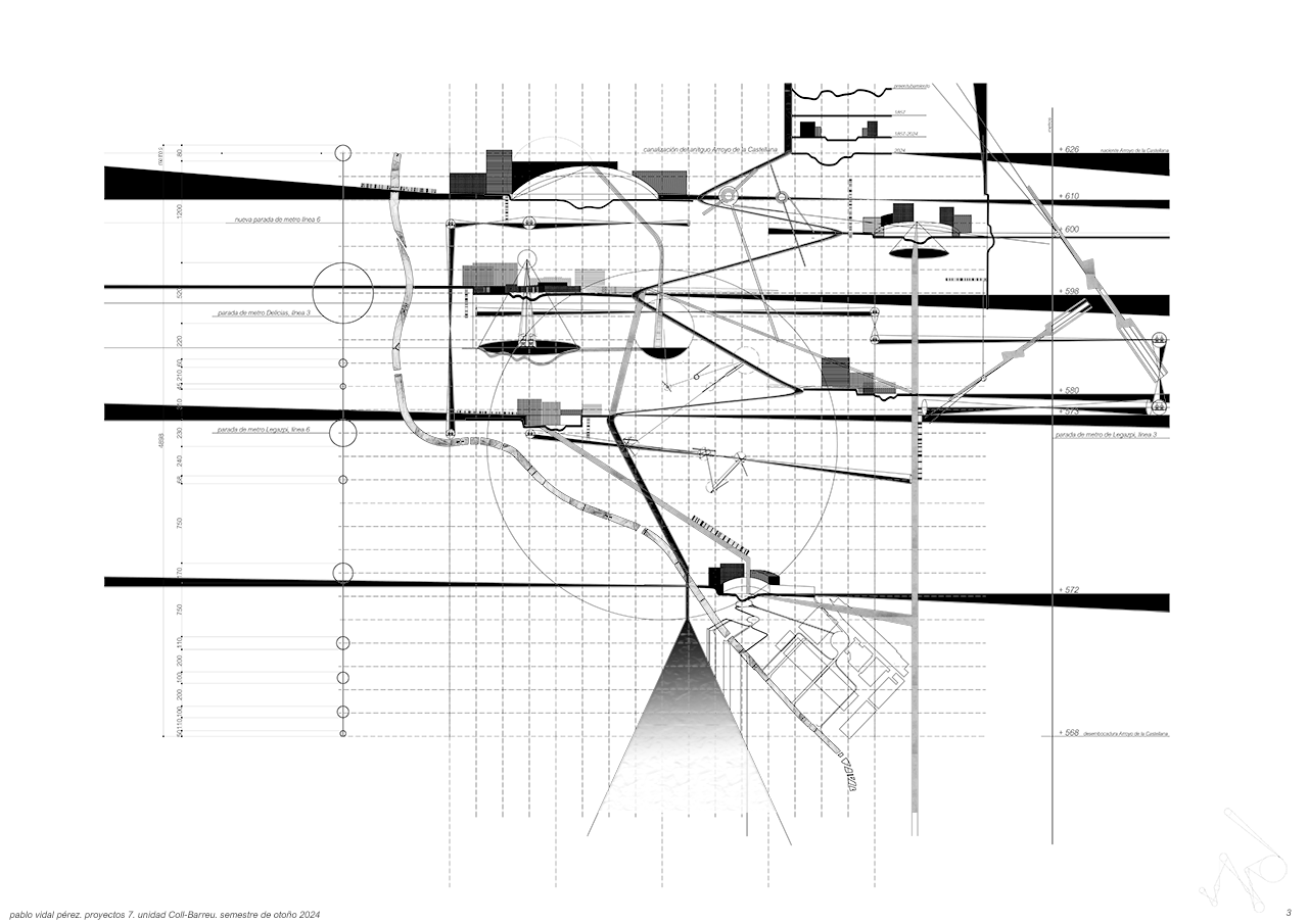
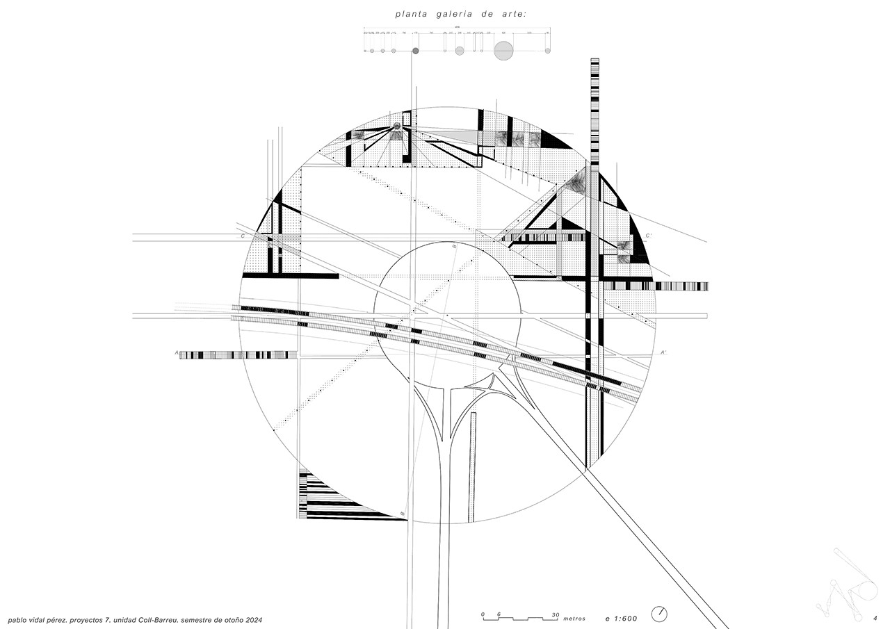
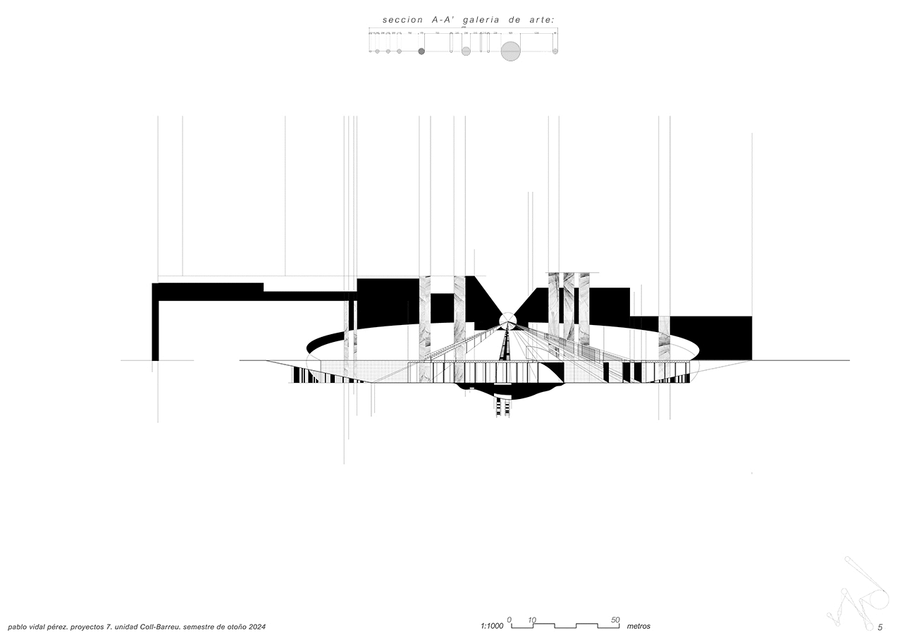
One of the hubs will include an art gallery with roofs formed by existing buildings that span over the excavation. This space will also feature two-level walkways connecting the street with the excavation and the stream. Heavy rail transport lines will also be visible and will cross the central lake that originates from the stream.
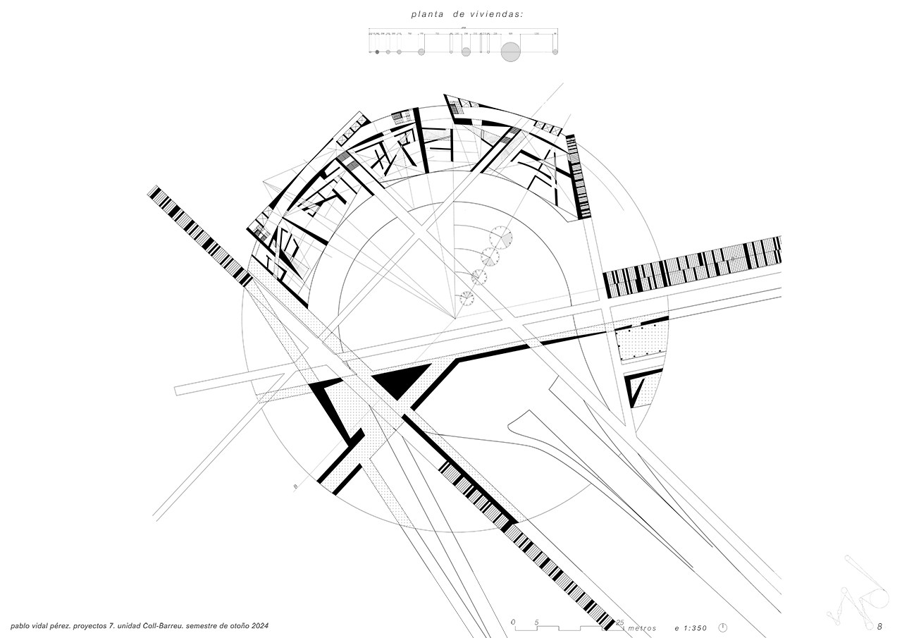
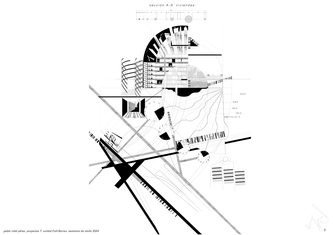
Another hub will house residences designed to connect both to the street level and to the level of the stream. Located near the Matadero, these homes will allow residents to enjoy the natural surroundings, offering activities such as swimming, farming, and other uses tied to the water flow and the seasons.
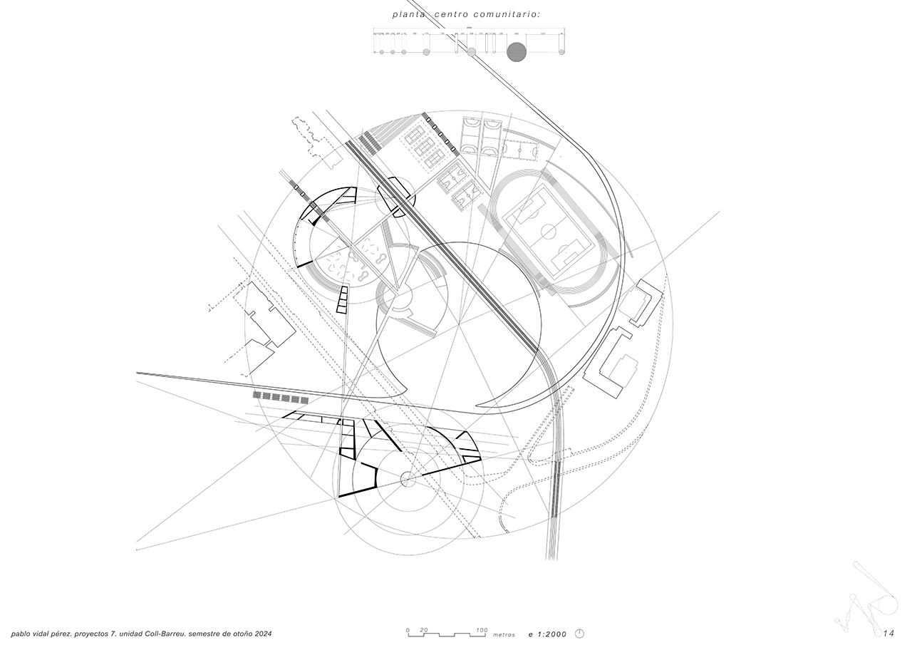
The largest hub, located at the intersection with Méndez Álvaro Street, will have a central lake with a diameter of 520 meters and a depth of 20 meters. In this space, a bridge will allow Méndez Álvaro Street to cross above, while the railway tracks will remain exposed and cross the lake, creating a significant visual and functional impact. This lake will be the focal point for a community and sports center planned for the hub.
The project not only reintroduces water as a vital element in the urban landscape but also transforms Madrid into a model of sustainability and urban innovation. Recovering the Arroyo de la Castellana also returns Madrid to its etymological meaning, "abundance of water streams," and establishes a connection between the city and its rich natural history.
The plan proposes to unearth the Arroyo de la Castellana through a large excavation in the southern part of Madrid. This new watercourse will start in Atocha and flow again into the Manzanares River. Two types of interventions will be developed in the excavated area: circular and deep excavations and shallower ones that will connect the hubs, guiding the stream along its path.
The circular hubs will be large areas with bodies of water at their centers, each associated with an architectural space with a specific program. The shallower excavations will form natural channels that connect the hubs and allow the water to flow toward its ending. This strategy will not only recover the historic stream but also transform the entire city.
On the excavated land, housing, parks, art galleries, and community centers will be created, all directly interacting with the stream. This initiative will form a green axis that will revitalize the city and link its historical past with a sustainable future. In addition to recovering the stream, the project will explore the underground layers of Madrid, revealing existing infrastructure such as metro and railway lines, which will be harmoniously integrated into the design. The system of elevation changes in the hubs will allow the water to flow naturally from Atocha to the Manzanares.
One of the hubs will include an art gallery with roofs formed by existing buildings that span over the excavation. This space will also feature two-level walkways connecting the street with the excavation and the stream. Heavy rail transport lines will also be visible and will cross the central lake that originates from the stream.
Another hub will house residences designed to connect both to the street level and to the level of the stream. Located near the Matadero, these homes will allow residents to enjoy the natural surroundings, offering activities such as swimming, farming, and other uses tied to the water flow and the seasons.
The largest hub, located at the intersection with Méndez Álvaro Street, will have a central lake with a diameter of 520 meters and a depth of 20 meters. In this space, a bridge will allow Méndez Álvaro Street to cross above, while the railway tracks will remain exposed and cross the lake, creating a significant visual and functional impact. This lake will be the focal point for a community and sports center planned for the hub.
The project not only reintroduces water as a vital element in the urban landscape but also transforms Madrid into a model of sustainability and urban innovation. Recovering the Arroyo de la Castellana also returns Madrid to its etymological meaning, "abundance of water streams," and establishes a connection between the city and its rich natural history.

- 00 - Description
- 01 - ArroyodelaCastellana
- 02 - Location Plan
- 03 - General Section
- 04 - ArtGallery FloorPlan
- 05 - ArtGallery Section
- 06 - Housing FloorPlan
- 07 - Housing Section
- 08 - CommunityCentreFloor
- 09 - CommunityCentSection
- 10 - Video